- Government
-
- City Council & Mayor Ordinances Resolutions Agendas and Meetings Boards and Commissions City Charter Contact Us
- Departments A-Z Administration City Attorney City Manager City Recorder Court Human Resources Community Development Building Economic Development Planning Tourism Emergency Management
- Finance Library Municipal Services Billing (Water Bill) Police 9-1-1 Code Compliance Public Works Engineering Maintenance Operations
-
- Community
- Business
- How Do I
-
- Find info on Public meetings Apply for a job Apply for an internship Contact the City Council Submit a Public Records Request Report an issue in Newberg Find a leak Find pavement maintenance information View the City Events calendar Apply for a library card Find the city on Social Media
- Pay my Municipal Services Statement (Water Bill) Read my Municipal Services Statement (Water Bill) Access Municipal Services Programs Know if I need a building permit Apply for a building permit Schedule an inspection Recycle Buy Compost Get a water conservation kit
- Apply for a Police ride-along Volunteer as a Reserve Officer Pay My Parking Ticket File a Code Complaint Obtain an animal permit
-
Interactive City Map
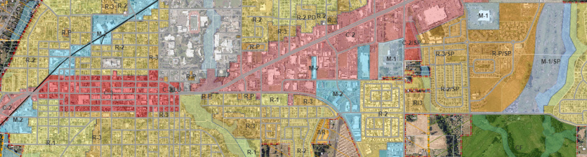
Click here to view the interactive city map. The interactive map uses many of the same tools as GIS to find information about a parcel.
To get started, click on the binoculars icon on the left hand side and then enter the numerical part of the address you are looking for (for example, if looking for 414 First Street, just enter the 414 part into the search box. You will then be able to scroll through a list of addresses that have the number 414 until you find the correct one to click on). Once you click on the correct address listing, the map will zoom to that parcel. Use the icon that looks like an i with a circle around it to find information about the parcel. On the right hand side of the map there are different layers you may use to find information - whichever layer is active (has the black dot filled in) is the layer you will be able to get information from.
There is also a link called "Tool Help" on the left side of the map that you may use to get more information about all the icons and how to use them.